Tuesday, May 21, 2013

New Jersey, New York and a Turtle

We are getting real good at these ferry crossings. . Again we decided to save gas money and take a ferry from Lewe, Delaware to Cape May, New Jersey. We made arrangements to take the 12:45 crossing, but got there just as the 11:30 one was ready to leave.


So they quickly got us on board and we were on our way. It was a beautiful day to enjoy the sunshine and ocean breeze.


 We were pleasantly surprised at the scenery in southeastern New Jersey. We understand now why it is called the Garden State. I wish I knew all the names of the trees that were in bloom. There were some beautiful purple trees, that almost looked like lilac bushes and also some red flowering trees lining the Garden State Parkway. The down side of all the flowering trees is the pollen. In the morning it looked like it had snowed on our vehicle. It was thick with yellow "Fairy Dust". It also put my allergies in high gear.


We visited a cute town called Smithville. They have a quaint historic village with lots of unique little shops. I'm sure Fred may be having second thoughts of going there, because I did a good amount of shopping. But now I have almost finished decorating the inside of the RV!!

It was a pleasant day to go to Atlantic City. We haven't had any luck gambling this week. We didn't win the Powerball or at the slot machines in the Trump Casino.


We did see some of the damage done by Hurricane Sandy last October, but for the most part, the Boardwalk looks good. We decided that we liked the Broadway at Ocean City better. It had the feel of a down to earth  fun place where as Atlantic City was a bit hootie tootie for our taste.


Fred wanted to see the 9/11 Memorial in New York City while we were in the area, but we had no desire to drive into the city on our own.  We were able to drive about 30 miles north of us to Tom's River NJ and take an express bus into the Port Authority in Manhattan. From there we took a subway to lower Manhattan. They definitely have a system for getting people into the Memorial. First we waited about 30 minutes in line so that we could get tickets. The tickets are free. You can get them on line ahead of time, but we didn't know that. Once you have your tickets, its a six block walk over to ground zero. There it took us about 40 minutes to go through the security line. You have to have purses, backpacks etc. go through the x-ray machines like at the airport. We had to go through a metal detector. Once inside the memorial, the first thing that I saw was the BIGGEST rat, running through the construction site next door. I figured that this was  typical for New York.

The Memorial itself if very nice. There are two infinity like pools. Each one in the foot print of the two World Trade Center buildings. The pools are four sided with a waterfall flowing from all four sides, with another four sided waterfall in the middle that gives you the impression that it has no bottom. The names of the people killed in the February 1993 bombing are on the north pool and the victims from the 9/11 bombing on the south pool. Eventually, there will be a museum there.


We also saw the Survivor Tree. After the bombing, this tree was damaged, however, someone decided that it should be saved and it's the only tree that was in the area back then that did survive.


We were also able to see the new buildings going up in the area. (There were a total of nine buildings torn down in the area after 9/11). This building is now the tallest building in the United States.


While the 9/11 Memorial was interesting and it gave you a humbling feeling seeing and imaging what took place here, I still did not like New York. Too many people and too much noise for me.

The most exciting part of this area was trying to leave the campground this morning... When we went out to hook up the truck we found one of the biggest snapping turtles relaxing under our vehicle.


The picture doesn't do him any justice, because he had to be 16 - 18 inches across. I'm sure that Fred and I looked hilarious, trying to get this guy out of the way. First I had to push it under the truck a bit so that Fred could move the truck.

Then Fred and I equipped with walking sticks and the garden hose tried to encourage him to move. Needless to say, he did not like this. He was hissing and snapping at us. And the nails this guy had!! Boy, he could have done some serious damage to a finger. We finally succeeded into flipping him over and scooting him across the ground on his back. Once we got him out of the way so we could hook up the RV, he walked over and settled under someone else's rig. If anyone had taken a video of us, I think it could have one a prize on America's Funniest Videos.

Saturday, May 18, 2013

Happy Anniversary!

It was 50 years ago today, that my dad married Jean, and I got a new mom.


 Wishing them many more years of happiness. Love to both of you.

Friday, May 17, 2013

The Eastern Shore

I have always prided myself on being a brave and adventurous person, but something has happened as I have gotten older. I have developed a fear of heights. It's not just being on a ladder, it's also crossing over anything that's not close to the ground, like bridges. When leaving Williamsburg we had the choice of driving 340 miles by land or 107 miles including the bridge..we took the bridge. The 20 mile ride over the Chesapeake Bay was an experience!! This included three bridges and two tunnels.


In this case it wasn't so much the bridges that were scary, it was looking off into the distance and realizing that the road seemed to stop ahead of us. And I have to admit, it really wasn't that bad.


The Eastern Shore is what they call the northern part of Virginia that is under Maryland, it also includes the part of Maryland that is south of Delaware. It is a beautiful place! It's mostly old fishing towns and surprisingly farmland.

Perdue Farms (as in Jim Perdue and his chickens) has their corporate headquarters in Salisbury Maryland and several processing plants in the area. Tyson Foods also has processing plants here too. So most of the produce including fields of marigolds are used to feed the chickens. Of course there are also lots of chicken farmers in the area. The winds were favorable most of the time, but I'm sure the neighbors don't always appreciate the chicken farmers!!

We spent parts of two days enjoying the wild horses of Asseteague. One day we went to the south portion of the Asseteague National Seashore and the Island of Chincoteague. The town itself is charming and we had a wonderful seafood lunch there. The drive over the causeway is something else. As you approach the causeway, you see beautiful marshland on both sides of the road. We saw numerous different kinds of birds, from egrets to gulls. As you round the crest of the first bridge and you look to the north...and all you see are billboards.... It's so sad, that they felt the need to ruin such a beautiful view with dozens of billboards.

We did stop at the State Park's Visitor Center and learned how the Fire Department of Chincoteague have been taking care of the wild horses for years. There are two stories as to where these horses came from: they are either descendants of Spanish horses that swam ashore from a ship wrecked galleon, or they are descendants from colonial times, when the colonists put their horses on the island to graze in order to avoid paying a livestock tax.


In order to control the population of horses at the south end of the island. The Chincoteague Fire Department holds a roundup every year in July called the Pony Penning. They swim the horses across the water from Asseteague Island to Chincoteague Island and then auction off some of the horses.


They try to keep the herd at 150 horses. Unfortunately here, you can't get up close to the horses.


In addition, there are wonderful trails around the island where we saw the rare Delmarva fox squirell. We were hoping to see the Sitka elk, but maybe next time.


And what day would be complete without a geocache at the lighthouse. So far we have thirteen straight days of caching!!


Another day we drove up to the northern part of Asseteague Island and saw some of the horses that the National Park maintains.


Here we were able to see a few of the horses up close.


They have several campgrounds on the island, so we talked to a ranger and a volunteer couple about being hosts.


Always planning ahead. I would love to spend a few months here, watching the horses and walking the beaches.


A trip to the Eastern Shore is not complete without going to Ocean City Maryland. We have never been to a place like this before... It was a carnival atmosphere on the beach.


We never saw so many hot dog stands, funnel cake shops, and t shirt stands. We were going to eat some good fresh seafood, but the temptation was to much.  Let's just say it wasn't a healthy lunch! They were still doing some repairs and clean up from Hurricane Sandy, but I'm sure things will be hopping come Memorial Day weekend.


 One thing that we enjoy about our travels is visiting with old friends. I have a high school friend who now lives in Salisbury Maryland. Unfortunately, she was back in Kenosha visiting her sister, but Fred and I were able to spend an evening with her husband.

The campground that we stayed at was in the middle of nowhere. It was almost ten miles from the nearest town, but it was so peaceful. There were very few other campers, so it was very quiet. We spent a quiet day relaxing, doing laundry, some minor household chores, reading and wandering along the marsh.


Life doesn't get any better than this!

Tuesday, May 14, 2013

History Lessons in Virginia

I never cared for the career that I ended up in.  As my family knows, for years I would say "When I grow up I want to be a Park Ranger." Well the other career that I would have liked to have was a history teacher.  However, those that know me also know that I have no patience for that. But to this day I still love to learn more about United States history and there is no better place to do that then on the East coast.

We had a picture perfect day for travelling from the Outer Banks NC to Williamsburg VA.  Along the way we stopped at the Great Dismal Swamp. (For those of you who have read the Diana Galbadon's Outlander series, William gets lost in this swamp!)


George Washington was the surveyor, who surveyed this area so that the canal could be dug for the inland waterway.

We stopped at the Great Dismal Swamp State Park and had a nice lunch in the RV and then took a short walk on the nature trail. There is one advantage of visiting this area early in May..no mosquitoes yet.


The good weather only lasted long enough for us to arrive at the campground and then the heavens opened up on us. But we have gotten really good at setting up the RV, so it wasn't too bad. We again stayed at a Thousand Trails campground. It was a muddy mess when we arrived, but quickly drained and dried up once it quit raining.

Our first history lesson was Jamestown. The first colony settled in the United States in 1607. We thought we'd stay a few hours here, but it was so fascinating that we spent the whole day.  There is actually two sections to seeing Jamestown. The first is a recreation of the original colony, it is a short distance away from where the original colony was located.


 The village has been recreated to look like it did back in 1607.  It was nice, but if you've seen other recreated towns, it doesn't look that different.


 The real interesting part was the archaeology site. This is located where the original colony was located. We went on a very interesting talk that lasted about an hour. The young man leading the tour was excellent. He did a great job of explaining why they picked the site that they did.  How they interacted with the Native Americans. And what went wrong. Or at least what they think went wrong. Through the archaeology research they are still learning what happened back then.


Just last week, it was confirmed that the colonists had to resort to cannibalism in order to survive. We were able to see the ongoing dig where they found the remains of "Jane" the young girl who was eaten.


They also had several "tall" ships that were reproductions of the types of ships that would have been in use during the early 1600's. When you actually see how small those ships were, it's a wonder anyone made it safely across the ocean.


We also learned that not everything you see in a movie these days is accurate. If you've ever watched the Disney movie Pocahontas, you would know that she married John Smith. Wrong. She actually married a colonists named John Rolfe. She went back to England with him and died within two years. Not the  feel good story that Disney portrays.


The second history lesson that we had was at Colonial Williamsburg. This is another town that has been recreated.
The Royal Governor's Palace
There are over 100 buildings in the town that are either the original buildings or have been reproduced to look like the original buildings that stood there during the American Revolution. There are people portraying characters that would have lived in the village during this period.

A local merchant
Depending on who is being portrayed, they tell you their story either from a Loyalist or a Patriots point of view. Walking in the village, you may encounter the Royal Governor, Patrick Henry, the local blacksmith or the owner of the local tavern.

 The most interesting person that we encountered was a man portraying a slave on a nearby plantation. He explained that he didn't want to give you the impression of a typical slave, but wanted us to realize that the majority of the people standing in the slave cabin with him probably were not descendants of upper class people. Most of the early settlers that came to America came here to find a better life for themselves and for their families. This meant that most of our ancestors struggled to survive. They experienced more hardship in one a day, a week, a month  than most of us will experience in our life time. And that most of them started out as farmers, laborers or poor tradesmen living in a dirt floor shack just like the one that a typical slave lived in.

It was an interesting analogy that neither Fred nor I had ever considered. It gave me a lot more respect for my  great great great (etc) grandfather who I have traced back to what is now Maine back in 1680.

I have to admit that Colonial Williamsburg was not quite what I expected it to be. I thought that there would have been more interaction with colonists in the streets. More merchants and town folks walking around, or maybe a group of soldiers drilling in the parade grounds in front of the Governor's Mansion.  But this could have been that we were there the second week of May and the real season does not start until Memorial Day. But overall, it was an interesting place to visit. We also did some interesting virtual geocaches in the town.

The last historical site that we went to was Yorktown. It was the least impressive of the sites that we've seen, but historically it was the most important place. This was the site of the determining battle during the American Revolutionary War. It was here that George Washington, Lafayette and thousands of soldiers eventually defeated Cornwallis forcing him to surrender. This was the turning point in the war that culminated in the formation of the United States of America!!

Fred trying out a musket, it is long and heavy

Re-Enactors shooting off the cannon

Victory Memorial


We listened to another wonderful talk by a National Park Service Ranger. There isn't much to see at Yorktown, except for the field where the battle took place. But the talk was so good, that if you closed your eyes, you could envision that battle that took place, smell the gunpowder in the air, feel the ground tremble with each cannon blast. It was very moving.


The old village of Yorktown is now filled with shops and restaurants and a very nice river walk. We had a quiet lunch on the shores of the York River, and of course, found a few geocaches in the area as well.


Friday, May 10, 2013

Cape Hatteras

Sunshine, wind, sand and sea. When I think of Cape Hatteras and the National Seashore I think of strolling on the beach with the waves crashing on the shore. Unfortunately for me, Fred does not share my same enthusiasm for the ocean. Though we did see a lot of interesting sights, we only walked the beach once.  But there were so many other interesting things to see and do that we ended up staying an extra day so we could get it all done.

We stayed at a really great campground in Wave NC, just south of Rodanthe (If you are a Nicolas Sparks fan, you've heard of Rodanthe) called Camp Hatteras. The Island is not very wide at this point, maybe a quarter of a mile across and the campground is on both sides of the road. We opted to stay on the Sound side (Pamlico Sound) rather than the ocean side. We are so glad that we did: First, the sand dunes on the ocean side are so tall that you can't even see the water, two the sound of the waves crashing all night long did not interrupt our sleep and third, but not last, we were able to enjoy the beautiful sunsets.


Unfortunately, we never seem to utilize the amenities at these campgrounds that we are staying at.

We learnt that there are five lighthouses along the Outer Banks. We were lucky enough to have seen four of them. The first one was the solid white one on Orcacoke. The second one is probably the most popular and the most photographed lighthouse in the United States.


The Cape Hatteras lighthouse with its black and white spiral stripes. We saw a wonderful movie at the Visitor's Center that showed how they moved the lighthouse from it's original location almost 3000 feet away to it's new location in 1999. It had to be moved because of severe erosion. It was an amazing feat of workmanship!! We could have taken the opportunity to climb the 200 plus steps to the top of the lighthouse, but I won't do it because of my fear of heights and Fred says that when they start telling you the number of steps, it's probably not going to be a fun experience!!  We were content to look at it from ground level.


The second lighthouse that we saw was the Bodie Lighthouse. This one is a bit smaller than Hatteras and is identified by it's horizontal bands of black and white stripes.


 Each band is 27 feet wide!!

 Even if we had wanted to climb up to the top of this one, we could not.  There were storm cells in the area and they do not allow you up to the top if there is a threat of lightning. Something to do with being the tallest thing for miles around and climbing up metal stairs! For those of you brave enough and in better shape then we are, they do charge an additional fee in order to climb to the top of the lighthouse.


The last lighthouse that we saw was the Currituck Lighthouse on the northern end of the Island.


We never did find out what the theory was behind the different colors of the lighthouses. Ocracoke was all white, Hatteras, Bodie and the one we didn't see Cape Lookout are all black and white (different patterns obviously so sailors could distinguish between the three from the sea, with Cape Lookout having large black and white diamond shapes on it). And then Currituck being just the natural red brick. It doesn't matter what they look like I never get tired of visiting a lighthouse.

One of the most unique and interesting places that we visited was the Chicamacomico Life Savings Station in Rodanthe. The couple Linda and James who are volunteers and run the place gave a fascinating presentation of the site. There were numerous life saving stations up and down the coast. While people come to this area all the time to see the lighthouses and marvel at how they saved the ships from disaster...it was really the men of the life saving stations who were the unsung hero.  Of the 178,000 people who were on ships that went down off the Outer Banks, 177,000 were rescued by the life saving stations!!!

These men went out in these little boats as a five man crew and picked up the ship wrecked people and brought them back to shore, giving them medical attention, food, clothing and a place to stay until another ship could come and get them. Most of the time, the ships wrecked because of a storm, but it didn't matter to these men how bad the weather was, it was their job to rescue and save. These were the precursors to the current US Coast Guard of today.


This was one of the most interesting presentations that we have seen in awhile. If you are ever in the area, it is definitely a must see.

1874 Life Saving Station
1911 Life Saving Station

As a side note, Linda at the station, told us about the experience in the town of Rodanthe when they filmed the Nicolas Sparks movie, Nights in Rodanthe there. She is hilarious.

She had a bit part in the movie as a patient of the Richard Gere character. In the movie he had to give her CPR. As she says, "Who wouldn't want Richard Gere to give them mouth to mouth and chest compressions." She said that she's probably the only person getting CPR with a smile on her face!!!  The building with the blue shutters was the Inn at Rodanthe where Richard Gere and Diana Lane were at. It is now a private home.


We of course can not go places without Fred looking up a geocache or two, or three or.... We were able to do several of them while on the Island. Sometimes it works out perfectly with places that we are already going to visit as was the case when we went to the Wright Brothers National Monument in Kitty Hawk.


This was a virtual cache which means that there is no hidden container to find. Instead, you have to get some information from the area that you are sent to. You usually have to answer a few questions and in some cases you have to post a picture of yourself and maybe your GPS at a certain location or with a certain item or place in the background. Here is Fred at the geocache location in Kitty Hawk.


While Fred likes to document his visits with a geocache, I prefer to take a picture in front of the sign.


 Since Fred has a difficult time figuring out how to use the cameras and centering a person within a shot (see if you can find me in the picture of the Currituck Lighthouse..) Fred is usually the one in my pictures.  It was very interesting to see the technology and thought process that these men had back in the early 1900's and how the basic mechanics of flight has changed very little over the past 110 years.


Just for fun (well I think it's funny, we'll see what Fred has to say once he's found out that I posted these) here are some of the pictures that Fred has taken.

The Lighthouse Keepers House at Cape Hatteras

Bodie Lighthouse
At least you can see me, just not the rest of the picture!!!

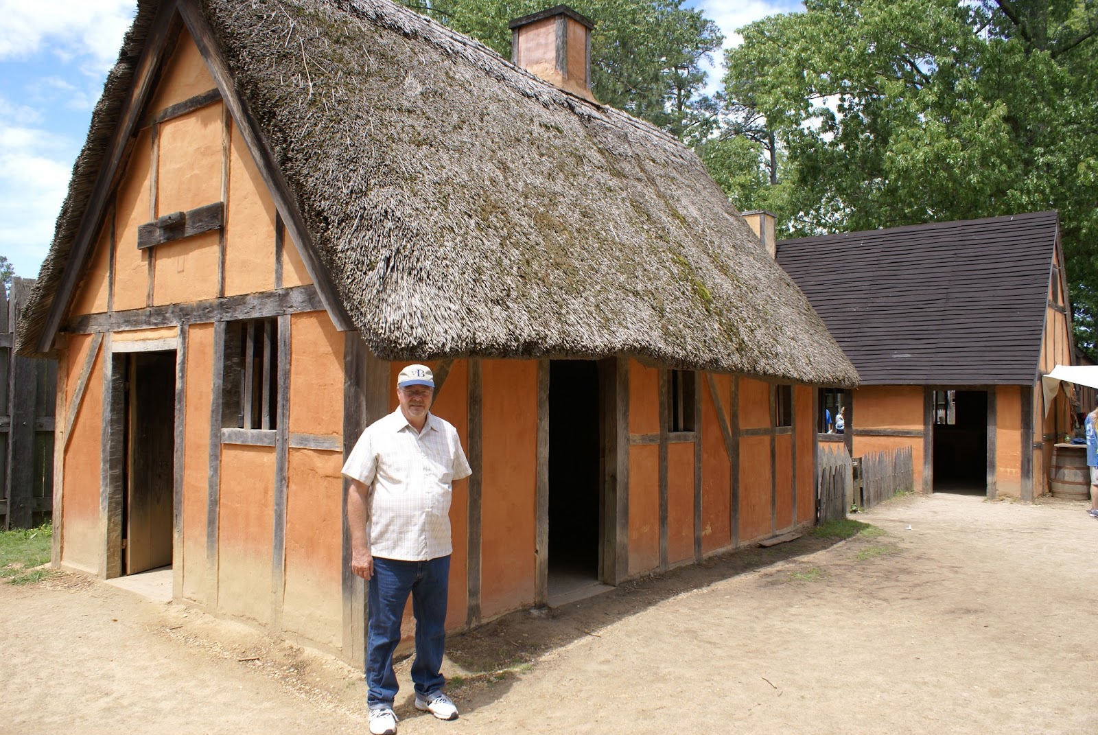
The last place that we visited on Hatteras was Fort Raleigh and the original Roanake settlement.


It was shocking to hear how unprepared these settlers were for life here in America. You wonder what was going through their minds and what their lives must have been like back in England for them to leave everything and everyone that they knew to pursue a new life in a wild and mostly unknown environment.


People say that Fred and I are adventurous because we like to travel and see new and different things. But we know where we are going and in most cases what to expect when we get there. I don't know if I would have made a good pioneer.


Wednesday, May 8, 2013

Outer Banks North Carolina - Ocracoke Island

Sunday morning started out very early. We had a reservation on the Cedar Point to Ocracoke ferry at 10:00 in the morning. We had to break down camp and drive the hour and a half to the ferry terminal. We had to be there 30 minutes early so we were on the road by 7:30. It was amazing how hard the wind was blowing at the ferry terminal.  It was so bad, that I could barely keep the truck door open, because it kept trying to blow shut!!  We've taken an RV on a ferry before (to Newfoundland and back and to Prince Edward Island), but there was something about this time that was a bit unnerving to me.  Maybe because now it was our house and all our worldly possessions...


I'm not sure why, but I was very apprehensive during the whole two and a half hour, 20 plus mile crossing.  We were the only RV on the ferry and it looked HUGE next to all the little cars. Plus we weigh over 10 tons, so you wonder how the ferry didn't list to one side....Watching it swag side to side almost made me dizzy.  Thank goodness I don't get seasick. Thankfully, they knew what they were doing and we made it across safely.


Ocracoke Island is so cute!! We were able to leave the truck and RV at the ferry parking lot and it was only a  short walk into town.  It's common practice in town to drive golf carts on the roads to get around. So it was much easier to rent a golf cart for a few hours than try to navigate with our 53 foot long rig. Our first stop was to complete a geocache on the island. There is so much history here.

The geocache was of a British Cemetery where 2 naval soldiers from World War II were interned. We learned that Germany had U boat submarines along the eastern coast trying to prevent supplies from  getting to England and Europe during the early part of the war. Prior to the United State's direct involvement in the war, the British Navy patrolled the east coast, however, one British ship did get hit by a torpedo and these soldiers washed ashore on Ocracoke Island.


Of course no visit to the island is complete without a visit to the lighthouse. This isn't one of the fanciest lighthouses, but it was still interesting to see it and the lighthouse keepers house next to it. The house is now privately owned.  How cool to have a lighthouse in your backyard!


The whole island is less than 10 square miles so it didn't take long to see it all. We picked up the truck and RV and headed to the north end of the island.


At one time the island had a herd of wild horses. There are now 24 of them that are corralled along the side of the road.


Isn't this the most tranquil setting you've ever seen!

The day was not complete without our second ferry ride of the day. This time we took the ferry from Ocracoke Island to Hatteras Island. This ride was much smoother and faster that the first one. 

Tuesday, May 7, 2013

South Carolina to North Carolina

Our vacation continues and we continue to see interesting and wonderful sights. We didn't spend much time in South Carolina, but we did have a chance to stop at another NASCAR track. We enjoy racing, but we are not that into it that we have to attend races at every track..plus that's just way to expensive! And the races never seem to be happening when we are there (we always seem to be a week early or a week late).  But since we were within a few miles of Darlington Speedway, we stopped and looked around.


We were disappointed that we could not see the track, but we did get a chance to see the museum and the Hall of Fame that is there.


Our travels then took us to New Bern, NC the birthplace of Pepsi Cola.


We thought that there was a museum here, but it was really just a gift shop and they didn't even give free samples. But Fred still prefers Pepsi over Coke any day!!

We stayed in Morehead City NC for two nights and spent Saturday roaming the little towns in the area.  We went to the Museum of the Atlantic in Beaufort and learned about the pirate Blackbird and his reign of terror in the area.  We also were lucky in that there was a wooden boat show going on that day, so we saw lots of interesting models of wooden boats and schooners. Beaufort is a quaint little town and we enjoyed walking through the downtown area and seeing the cute shops.